Input data
The NetCDF data used to initialize SeaRISE runs is freely-available online.
To download the specific file we want, namely Greenland_5km_v1.1.nc, and preprocess it
for PISM, do:
cd examples/std-greenland
./preprocess.sh
The script preprocess.sh requires wget and also the NetCDF Operators. It
downloads the version 1.1 of the SeaRISE “master” present-day data set, which contains ice
thickness and bedrock topography from BEDMAP [6], and modeled
precipitation and surface mass balance rates from RACMO [7], among
other fields.
In particular, it creates three new NetCDF files which can be read by PISM. The
spatially-varying fields, with adjusted metadata, go in pism_Greenland_5km_v1.1.nc.
The other two new files contain famous time-dependent paleo-climate records from ice and
seabed cores: pism_dT.nc has the GRIP temperature record [8] and
pism_dSL.nc has the SPECMAP sea level record [9].
Any of these NetCDF files can be viewed with ncview or other NetCDF visualization
tools; see Table 20. An application of IDV to the master data set produced
Fig. 1, for example. Use ncdump -h to see the metadata and history of
the files.
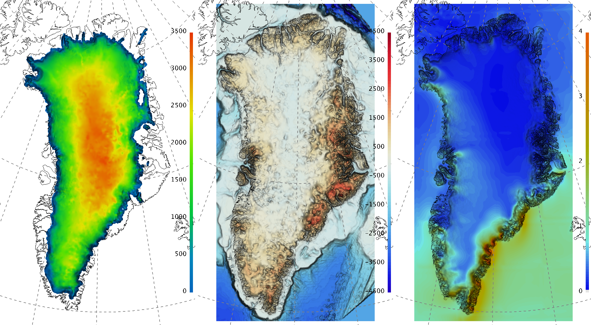
Fig. 1 The input file contains present-day ice thickness (left; m), bedrock elevation (center;
m), and present-day precipitation (right; \(m / year\) ice equivalent) for
SeaRISE-Greenland. These are fields thk, topg, and precipitation,
respectively, in pism_Greenland_5km_v1.1.nc.
| Previous | Up | Next |